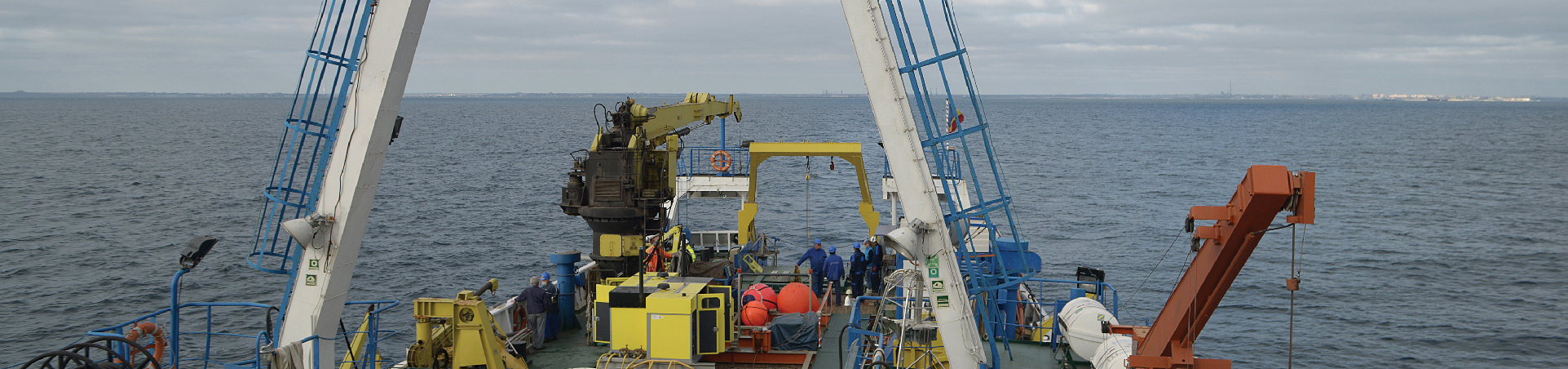
GeoPontica Network
The network of permanent GNSS stations "GeoPontica", designed with the main purpose of highlighting and then monitoring the movements suffered by the various tectonic blocks that make up the earth's crust corresponding to the western continental edge of the Black Sea, was installed and operational since 2013, having installed 13 stations in the coastal area of Romania.
The construction of the network of permanent GNSS stations was preceded by feasibility studies that established the optimal locations for the location of equipment according to a series of specific criteria: - ensuring the security of the geodynamic station (pillar, GNSS receiver, auxiliary equipment, etc.) / 7;
- the existence of a low probability of producing anthropogenic changes in the future;
- the existence of specific geotechnical conditions (embedding the pillar in the living rock, minimum seasonal and annual variations of the underground hydrostatic level, isolation of the pillar from the foundation of the building, etc.) as favorable as possible;
- the selected point must ensure a clear view of the sky, without obstructions greater than 15o;
- the point must be located at least 15 m from any source of reflection and more than 1 km from strong microwave sources;
- access to the point must be convenient, free and possible by car or naval means;
- the future access of the point must be possible for any Romanian user or his foreign collaborator, without restrictions from the land owner;
- it is preferable to have access to the national electricity network and the Internet;
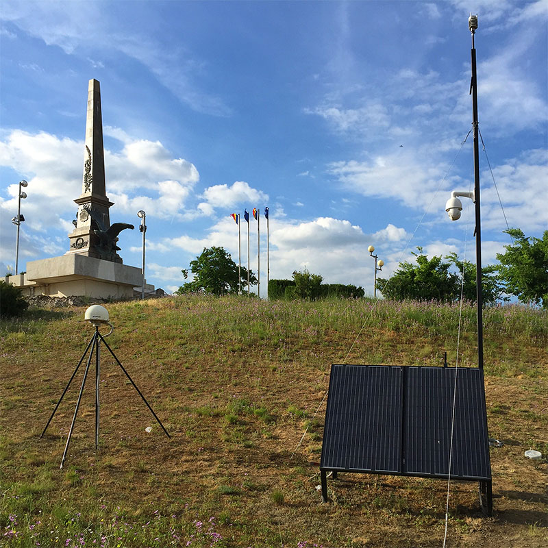
- the point must be located in the coverage area of the mobile telephony networks in order to be able to transmit the measured data in almost real time, etc. The main component elements of the complex geodynamic stations of the GeoPontica cross-border network are: - the monumentalized, drilled or weighted geodynamic pillar;
- GNSS receiver compatible with positioning systems using satellites: GPS, GLONASS, GALILEO and COMPASS;
- the assembly consisting of the GNSS antenna, the base and the dome for the antenna;
- auxiliary sensors: meteorological (temperature, pressure, humidity, etc.), inclinometer, etc.
- power supply system: 220 V mains, buffer batteries, solar panels, etc.
- communication system: GPS / GPRS, public internet, bluetooth, etc.
- thermostatic equipment protection enclosure.
In order to monumentalize the geodynamic pillars located in locations where there are thick stacks of unconsolidated alluvial sediments on the surface, possibly affected by subsidence phenomena, it was decided to adopt the constructive solution recommended by the technical staff of the UNAVCO mega-project, called "deep drilled braced monument". For the locations located in more favorable technical conditions, the constructive solution “short drilled braced monument” was used.
Mainly both solutions consist in the execution of a vertical drilling and 4 drills inclined at 350, up to the actual depth of at least 10.5 m and 5-6 m respectively, reinforcement with steel pipes of the dug holes, cementing the resulting assembly and welding the heads pipe in the holder on which the GNSS antenna embassy is placed. Each permanent GNSS station of the GeoPontica network is equipped with the following equipment:
• Topcon GNSS receiver (reference station), model NET-G3A; • GNSS antenna: Topcon, model CR-G5 with base and dome (radome) absolutely calibrated by the German company Geo ++;
• auxiliary sensors: Vaisala weather station capable of measuring air temperature, wind speed, precipitation amount, barometric pressure, relative humidity, inclinometer, etc .;
• power supply system: solar panels, Kyocera manufacturer, model KD135GH-2PU and 220V alternating current system with back-up function on CSB batteries, model LPG 12120.
• communications system, consisting of 3G wireless broadband GSM / GPRS router Currently the character of the Geopontica network is passive, the 13 permanent GNSS stations transmitting via 3G networks the primary geodetic and meteorological data registered at the coordination center in Constanta (local branch of GeoEcoMar ). The locations of the 13 GNSS stations that make up the GeoPontica network: Chilia Veche, Sulina, Tulcea, Dunavăţ, Sfântu Gheorghe, Babadag, Perişor, Gura Portiţei, Chituc, Cap Midia, Agigea, Cap Tuzla.